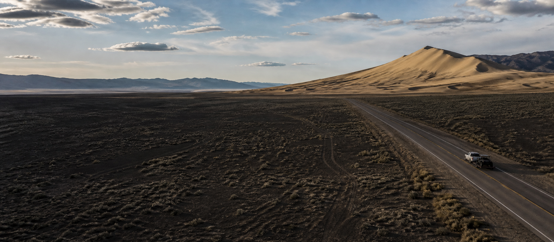

A tow rig approaching Sand Mountain across Nevada's Great Basin on U.S. Route 50

Know the boundary before the throttle

One map for arrival. Another for riding.

Two different maps do two different jobs here. The official BLM map settles what is legal. Everything below settles how you get there without incident and what to have saved before the signal thins.

The working trip map

Click a place. Get that place.

Every marker identifies the exact planning point and updates the matching detail card. Approximate orientation pins are labeled; official boundaries still control.

No cell service needed Camp Compass

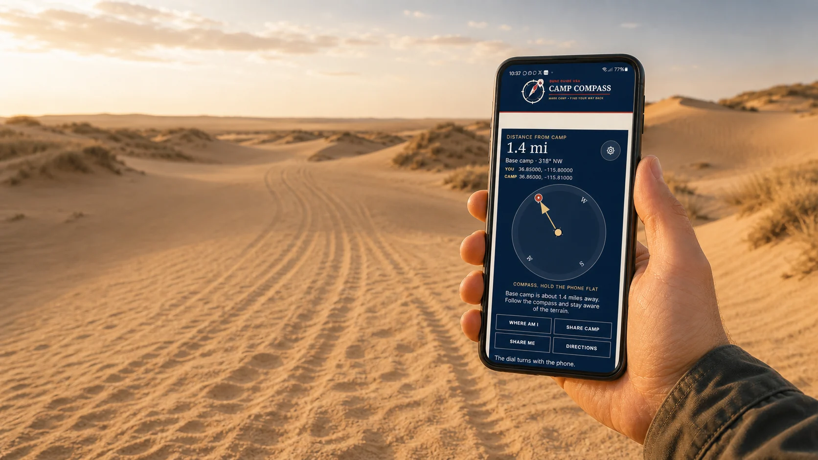
Camp Compass: find your way back.

Getting turned around on an open dune is ordinary, not careless. Every rise looks like the last one, tracks fill in, and the trailer you parked beside disappears the moment you drop over a crest.

Camp Compass does three things. It marks your camp so you can find it again, it points you back to it using GPS, and it shares your coordinates by text if you need help. The first two work with no cell service at all. Sending needs either cell coverage or a phone with satellite messaging.

  1. Set the location. Stand at the trailer, not fifty yards from it.
  2. Name it. Base camp, the truck, whatever you will recognise at dusk.
  3. If you get turned around, come back here. It gives you the direction and the distance.

This works without cell service. The satellite receiver in your phone listens to GPS and does not need a carrier or a signal bar. Marking camp, reading your position, and getting the direction and distance back all run on the device. Sending a message or opening driving directions are the only parts that need to reach out.

Cell coverage here is sporadic. BLM asks visitors to buy passes before arriving for exactly that reason. Load this page in Fallon while you still have bars, and leave the tab open.

The arrow is a straight line, not a route. It points at the coordinates you saved. It does not know about a wash, a fence, a closed area, or a dune face you cannot climb. Use it to orient yourself, then pick a way that works.

Base campNot marked yetStand at the trailer and press Mark this spot.
YouNo fix yetPress Where am I to read the satellites.
Distance backNot yetStraight line over the ground.
Direction backNot yet

Nothing is sent anywhere on its own. The saved spot is stored on this phone only. Sharing is the one thing here that needs to reach the outside world, by cell coverage or satellite messaging. A text will often get through on one bar when data will not.

How Camp Compass works, and why GPS needs no cell signal →

Camp Compass is an orientation aid, not a rescue plan. A phone battery dies, a screen fails in the heat, and a fix can be tens of yards out. Carry a paper map, tell somebody your plan and your return time, and treat a handheld GPS or satellite messenger as the real equipment. If you are lost and low on water, staying put beside a visible machine is usually safer than walking.

The turn is the hard part

Sand Mountain lies along U.S. 50 roughly 25 miles southeast of Fallon. Coming from Fallon the entrance is a left turn across oncoming traffic, and there is no left-turn lane. You will be slowing a loaded rig in a live highway lane while somebody closes on you from behind. Signal early, watch your mirrors, and give following traffic time to work out what is happening. This is the most dangerous thirty seconds of the trip and it happens before you touch sand.

Save everything before Fallon

Mobile service at the dunes is patchy and unreliable. Download the official BLM map, your route, the recreation pass confirmation, and any current notices while you still have signal. Harmon Station, the last stop on U.S. 50 as the highway turns from east to south, has Wi-Fi and sells passes, which makes it the practical last chance to finish anything online.

Open dune, then designated trail

The open riding area is the dune field itself. Around it sits roughly 23 miles of designated route, and outside the open area those routes are where you belong. The distinction is not decorative: it is what keeps machines off Kearney buckwheat and the Sand Mountain blue butterfly, which exists on this dune and nowhere else on Earth.

The closures are signed and maintained

BLM signs the closed areas and keeps that signage up. If tracks run past a sign, that is evidence somebody else ignored it, not that the boundary moved. A pin dropped on a personal map is not proof a route is legal or open. Use the official map for anything that could put you inside a closure.

History sits inside the boundary

The Sand Springs Pony Express Station is within the recreation area, and the low stone walls are still there to walk up to. It deserves a stop and it does not deserve to be used as a staging area. Park away from it, walk in, and keep machines off the site itself.

Mark camp before anyone rides

Save your camp coordinates and share them with every driver and rider before the first machine moves. Agree regroup points in advance rather than improvising them over a radio. On an open dune with no landmarks that survive a wind shift, a shared pin is the difference between a delay and a search.

Two maps, and know which is which

The interactive map on this page is for planning: arrival, services, camping context, and the historic site. The BLM map is for legality: boundaries, closures, and designated routes. When they disagree, BLM is right and this page is wrong. Carry both offline.

Verify before travel. Conditions and regulations can change. Use the responsible agency's current information for final decisions.

Open the official BLM source →
Part of theDUNE GUIDE USA NETWORKLocally built dune guides. One place to start.